Sunday, January 21, 2024

Fun training weekend with Slate River

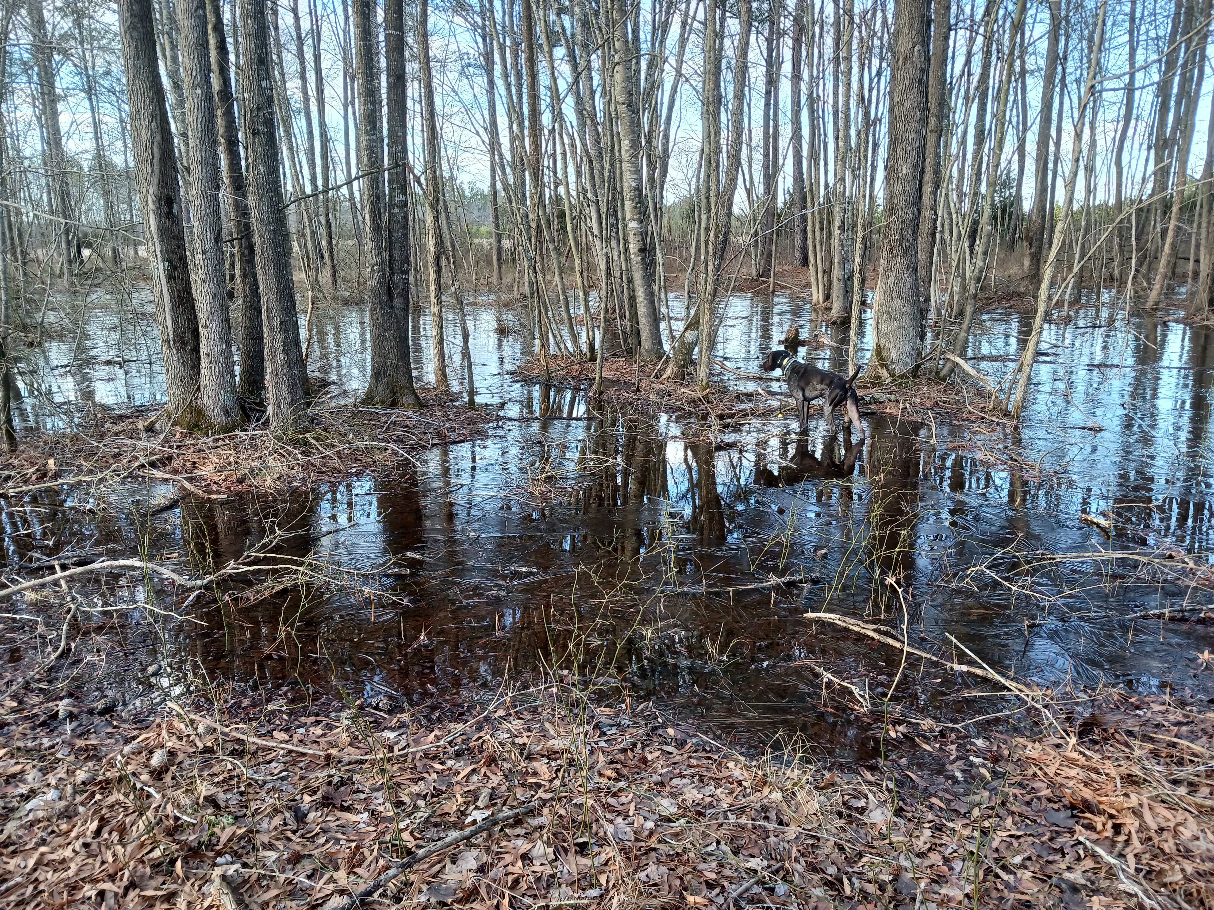
Worked on backing different breeds and being steady to many many many liberated quail. Even broke ice in pursuit of one covey.




Tuesday, January 9, 2024

Snowy conditions and trees growing out of old bridge supports

We didn't wipe out and both of us got a much harder workout moving in the parts with soft snow.


Mile marker 75.7                   
Killiansburg Cave
After the Battle of South Mountain, as the Confederate army retreated and settled in Sharpsburg, the town residents felt the tension mounting between the Confederates and the Federals. Many families left their homes to go stay with nearby relatives while others found refuge in caves, including the Killiansburg Cave, along the Potomac River. Out of the line of fire, the caves provided a safe haven for residents to gather until the battle ceased. (Source: www.canaltrust.org)

Mile marker 72.8                   
Ferry Hill Plantation
Ferry Hill sits on the high bluff overlooking the Potomac River and the C&O Canal, opposite Shepherdstown. The property has been a farm, a restaurant, an encampment for Union troops, and, at one time, the headquarters for the C&O Canal National Historical Park. Ferry Hill was built by Col. John Blackford in 1813 and once encompassed 700 acres. Blackford had one of the largest slaveholdings in the area, owning 18 slaves and hiring part-time laborers as well. In 1850 the Douglas family moved into the mansion with their four children, which included Henry Kyd Douglas. Henry enlisted in the Confederate army in 1861 and served as Stonewall Jackson’s youngest staff officer. Maryland was a border state but because Henry enlisted as a Confederate, the Federals kept the Douglases under house arrest for much of the Civil War. Ferry Hill was used by both armies during the war and wounded Confederates were cared for here following the September 17, 1862, Battle of Antietam. Henry’s father Robert was suspected of spying for the Confederates. The Federals arrested him and sent him to Fort McHenry, in Baltimore, for several months. (Source: www.canaltrust.org)

Mile Marker 72.7
Thomas Swearingen Ferry/James Rumsey Bridge
After the Virginia General Assembly recognized the need for a proper river crossing in 1755, the Swearingen family began operating a ferry across the Potomac between here and Shepherdstown. The ferry operated for more than 50 years until John Blackford, who married into the family, gained a controlling interest in 1816. Blackford, who built and lived at Ferry Hill Plantation, had two slaves who operated the ferry until service was discontinued in 1850 and the Virginia and Maryland Bridge Company built a covered wooden bridge. Potomac Bridge carried travelers across the river, though it was destroyed several times. In 1939, the bridge was rebuilt again and named after James Rumsey, inventor of the steamboat. It now carries Route 34 overhead.

On December 3, 1787, Rumsey’s steamboat, which used a type of hydraulic jet-propulsion, made its debut in this calm section of the Potomac River. Hundreds of spectators witnessed the craft, which started at Shepherdstown ferry landing and made its way upstream at a rate of four miles per hour. A 75-foot monument sits on the hillside in West Virginia to commemorate Rumsey’s first-in-steam navigation. (Source: www.canaltrust.org)

Mile marker 72.6                   
James Rumsey Monument and State Park
Just across the Potomac River on top of the cliff is the James Rumsey Monument and State Park. James Rumsey was a pioneer of steam navigation and was the first superintendent of the Patowmack Company, a position that George Washington recommended him for. On December 3, 1787, Rumsey’s steamboat, which used a type of hydraulic jet-propulsion, made its debut in this calm section of the Potomac River. Hundreds of spectators witnessed the craft make its way upstream from the Shepherdstown ferry landing at a rate of four miles per hour. A 75-foot monument sits on the hillside to commemorate Rumsey’s first-in-steam navigation. (Source: www.canaltrust.org)

Mile marker 71.4                   
Packhorse Ford
Also known as Blackford’s Ford, Boteler’s Ford, and Shepherdstown Ford, this is the site where Stonewall Jackson’s Command crossed en route from Harpers Ferry to Sharpsburg to join Confederate forces on September 17, 1862, during the Battle of Antietam. This is also where the entire Army of Northern withdrew into Virginia on September 18 and 19. (Source: www.canaltrust.org)


Monday, January 1, 2024

Back to back rides

Took advantage of the mild weather and day off to ride more. We saw chickens, fishermen, a Downy woodpecker, and an interior weir.


Sunday, December 31, 2023

Most different surfaces (so far)

Past midway! 

Packed dirt, gravel, pot hole laden side street, RR tracks, asphalt, and slippery wooden bridge on today's ride.


Mile marker 94.44                 
Falling Waters
Following the Confederate defeat at the Battle of Gettysburg, General Robert E. Lee and his troops withdrew into Maryland. Rain and high water levels made a retreat back into Virginia difficult so the army worked on making pontoon boats. Water levels subsided enough for the army to cross over fords at Falling Waters and also Williamsport, under darkness. (Source: www.canaltrust.org)


Mile Marker 88.1
McMahon’s Mill
The mill here has been known by a variety of different names: Shanks Mill, Charles Mill (not to be confused with Charles Mill just below Dam 5), Avis Mill, Shaffer’s Mill, Old Flouring Mill, Galloways Mill, Cedar Grove Mill, and more recently, McMahon’s Mill. The mill was built on Downey Branch in 1778 to produce flour, feed, and plaster. The wooden overshot wheel was replaced by a steel wheel in the 1920’s, when waterpower was used to generate electricity here. The mill closed in 1922. (Source: www.canaltrust.org)

Sunday, December 24, 2023

In the double digits now

Nice ride on a mild December day. Boozie went for a small swim before we loaded up.


Mile Marker 99.5

Bollman Bridge

The Bollman Bridge was constructed in 1879 and stands as a testament to nineteenth century engineering. This pony-Pratt iron truss bridge is one of the few surviving bridges built by Wendell Bollman, a pioneer in engineering of iron bridges. Prior to 1850, most bridges built in America were wooden. Bollman was a self-taught engineer who pioneered the “Bollman truss” design. (Source: www.canaltrust.org)


Mile marker 99.2-99.8           

Williamsport

Williamsport is the only place on the canal where examples of major canal structures can be viewed within a half-mile stretch of the towpath. Visitors can see a refurbished lockhouse and its adjacent lift lock, the only Bollman Iron Truss bridge over the canal, a railroad lift bridge, a canal turning basin and a re-watered aqueduct. The railroad lift bridge is a rare surviving example of a short-span railroad vertical lift bridge. It was built in 1923 by the Potomac Public Service Company, where the Western Maryland Railway spur crosses the canal. Cushwa Basin is the only restored historical basin on the C&O Canal. The basin was excavated and rebuilt in 1994. The Cushwa warehouse was built between 1790 and 1810, predating the canal. It is one of the oldest buildings along the canal. Adjacent to the basin, on its downstream side, was the Cushwa wharf. This, along with the Steffey and Findlay wharf near Lock 44, made Williamsport the most important coal shipment point on the canal above the Federal District. Replica launch boat rides over the re-watered Conococheague Aqueduct are offered seasonally. (Source: www.canaltrust.org)


Got fogged in on last hunt day

Limited hours and as we arrived other hunters leaving so... not alot of bird contacts but Boozie did have really great willow and white tail...